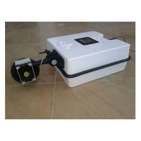
Sensors & Software – Ground Penetrating ...
Sensors & Software – Ground Penetrating Radar System | LMX200
Advanced GPR locating and reporting for professionals.
Advanced Subsurface Utility Detection with Unmatched Clarity and Confidence
The Sensors & Software LMX200™ Ground Penetrating Radar (GPR) System is a professional-grade tool engineered for infrastructure professionals, surveyors, engineers, and contractors. The LMX200 provides deep subsurface insights, high-resolution scanning, and data visualisation, making it ideal for utility locating, void detection, environmental assessments, and geophysical investigations.
As the most capable system in the LMX line, the LMX200 delivers advanced features and precision for professionals requiring reliable subsurface imaging and mapping.
Key Features and Benefits
Unmatched GPR Imaging with Enhanced Depth Penetration
Equipped with an ultra wideband 250 MHz antenna, the LMX200 provides deep penetration while maintaining high-resolution detail. Perfect for locating metallic and non-metallic utilities, PVC conduits, underground storage tanks (USTs), and subsurface anomalies—even in challenging soils and urban environments.
SmartStack™ and DynaQ™ Signal Enhancement Technologies
SmartStack™ signal enhancement and DynaQ™ automatic signal conditioning reduce noise and refine data, making interpretation of complex or noisy environments easier and more accurate.
High-Resolution Data with SplitView and MapView
SplitView displays LineView (cross-section) and MapView (grid view) simultaneously for full situational awareness and accurate asset marking. MapView compiles GPR data into geo-referenced 2D depth slices for post-processing and reporting.
Integrated GNSS and Optional External GPS
Includes a built-in GPS receiver for georeferenced data collection and supports high-accuracy external GNSS systems for survey-grade applications. Ideal for GIS integration and mapping workflows.
Wi-Fi, USB, and Cloud Connectivity
Data and reports can be transferred via USB, Wi-Fi, or cloud access. Simplifies real-time data sharing and reporting.
Custom Reports with EKKO Project™ Software
Process, interpret, and export results into professional reports with custom annotations, snapshots, depth slicing, and interpretation tools.
Built for Rugged Job Sites
Durable IP65-rated enclosure, 8.0" daylight-readable touchscreen, and all-terrain wheels ensure the system withstands tough field conditions, from construction zones to environmental sites.
Technical Specifications
Antenna Frequency: 250 MHz ultra wideband
Depth Penetration: Up to 8 m (26 ft), soil-dependent
Data Acquisition Rate: Up to 60 scans/second
Display: 8" high-resolution LCD, sunlight-readable
GPS: Internal GPS with external GNSS support
Data Export Formats: JPEG, CSV, KMZ, PDF, GPR, and EKKO Project native
Connectivity: USB, Wi-Fi, Cloud connectivity
Operating Temperature: -20°C to +50°C
Weight: Approx. 22 kg (including battery)
Battery Life: Up to 6 hours (field-swappable lithium-ion battery)
Optional Software: EKKO Project™
Applications
- Utility locating and mapping: Detect metallic and non-metallic utilities before excavation.
- Environmental assessment: Identify underground storage tanks (USTs) and contamination pathways.
- Construction and civil engineering: Map buried infrastructure, rebar, and post-tension cables.
- Archaeology and forensics: Detect historical structures and burial sites.
- Geotechnical and geological surveys: Locate sinkholes, voids, and rock interfaces.
Why Choose the LMX200 Over Other GPR Models
LMX100 vs. LMX200
Basic utility locating → Advanced utility mapping with post-processing
Single LineView → SplitView, depth slices, and interpretation tools
Limited connectivity → Wi-Fi, USB, and GPS integration
Minimal data export → Full report generation with EKKO Project™
No mapping capability → Full grid scanning with MapView
Included in the Box
- LMX200™ GPR System with integrated ultra wideband 250 MHz antenna
- Removable battery and charger
- Integrated GPS module
- USB drive for data export
- User manual and quick start guide
Optional Accessories
- External GPS antenna for survey-grade precision
- EKKO Project™ software for full report generation
- Spare lithium-ion battery
- Custom transit case
- Training and support packages
Order the LMX200 GPR System Today
The Sensors & Software LMX200 GPR System provides advanced tools for non-destructive subsurface investigation. With high-resolution imaging, GPS mapping, rugged mobility, and professional software, the LMX200 enables faster, safer, and more informed decision-making on every job site.
Contact us today for pricing or to discuss how the LMX200 can enhance your underground locating capabilities.
To contact Testrix about Sensors & Software – Ground Penetrating Radar System | LMX200 use Get a quote.
Advanced Subsurface Utility Detection with Unmatched Clarity and Confidence
The Sensors & Software LMX200™ Ground Penetrating Radar (GPR) System is a professional-grade tool engineered for infrastructure professionals, surveyors, engineers, and contractors. The LMX200 provides deep subsurface insights, high-resolution scanning, and data visualisation, making it ideal for utility locating, void detection, environmental assessments, and geophysical investigations.
As the most capable system in the LMX line, the LMX200 delivers advanced features and precision for professionals requiring reliable subsurface imaging and mapping.
Key Features and Benefits
Unmatched GPR Imaging with Enhanced Depth Penetration
Equipped with an ultra wideband 250 MHz antenna, the LMX200 provides deep penetration while maintaining high-resolution detail. Perfect for locating metallic and non-metallic utilities, PVC conduits, underground storage tanks (USTs), and subsurface anomalies—even in challenging soils and urban environments.
SmartStack™ and DynaQ™ Signal Enhancement Technologies
SmartStack™ signal enhancement and DynaQ™ automatic signal conditioning reduce noise and refine data, making interpretation of complex or noisy environments easier and more accurate.
High-Resolution Data with SplitView and MapView
SplitView displays LineView (cross-section) and MapView (grid view) simultaneously for full situational awareness and accurate asset marking. MapView compiles GPR data into geo-referenced 2D depth slices for post-processing and reporting.
Integrated GNSS and Optional External GPS
Includes a built-in GPS receiver for georeferenced data collection and supports high-accuracy external GNSS systems for survey-grade applications. Ideal for GIS integration and mapping workflows.
Wi-Fi, USB, and Cloud Connectivity
Data and reports can be transferred via USB, Wi-Fi, or cloud access. Simplifies real-time data sharing and reporting.
Custom Reports with EKKO Project™ Software
Process, interpret, and export results into professional reports with custom annotations, snapshots, depth slicing, and interpretation tools.
Built for Rugged Job Sites
Durable IP65-rated enclosure, 8.0" daylight-readable touchscreen, and all-terrain wheels ensure the system withstands tough field conditions, from construction zones to environmental sites.
Technical Specifications
Antenna Frequency: 250 MHz ultra wideband
Depth Penetration: Up to 8 m (26 ft), soil-dependent
Data Acquisition Rate: Up to 60 scans/second
Display: 8" high-resolution LCD, sunlight-readable
GPS: Internal GPS with external GNSS support
Data Export Formats: JPEG, CSV, KMZ, PDF, GPR, and EKKO Project native
Connectivity: USB, Wi-Fi, Cloud connectivity
Operating Temperature: -20°C to +50°C
Weight: Approx. 22 kg (including battery)
Battery Life: Up to 6 hours (field-swappable lithium-ion battery)
Optional Software: EKKO Project™
Applications
- Utility locating and mapping: Detect metallic and non-metallic utilities before excavation.
- Environmental assessment: Identify underground storage tanks (USTs) and contamination pathways.
- Construction and civil engineering: Map buried infrastructure, rebar, and post-tension cables.
- Archaeology and forensics: Detect historical structures and burial sites.
- Geotechnical and geological surveys: Locate sinkholes, voids, and rock interfaces.
Why Choose the LMX200 Over Other GPR Models
LMX100 vs. LMX200
Basic utility locating → Advanced utility mapping with post-processing
Single LineView → SplitView, depth slices, and interpretation tools
Limited connectivity → Wi-Fi, USB, and GPS integration
Minimal data export → Full report generation with EKKO Project™
No mapping capability → Full grid scanning with MapView
Included in the Box
- LMX200™ GPR System with integrated ultra wideband 250 MHz antenna
- Removable battery and charger
- Integrated GPS module
- USB drive for data export
- User manual and quick start guide
Optional Accessories
- External GPS antenna for survey-grade precision
- EKKO Project™ software for full report generation
- Spare lithium-ion battery
- Custom transit case
- Training and support packages
Order the LMX200 GPR System Today
The Sensors & Software LMX200 GPR System provides advanced tools for non-destructive subsurface investigation. With high-resolution imaging, GPS mapping, rugged mobility, and professional software, the LMX200 enables faster, safer, and more informed decision-making on every job site.
Contact us today for pricing or to discuss how the LMX200 can enhance your underground locating capabilities.
To contact Testrix about Sensors & Software – Ground Penetrating Radar System | LMX200 use Get a quote.
Calculating...
- Your delivery location?
- NSW
- VIC
- QLD
- SA
- WA
- NT
- ACT
- TAS
- New Zealand
- Papua New Guinea
- Afghanistan
- Albania
- Algeria
- Andorra
- Angola
- Antigua and Barbuda
- Argentina
- Armenia
- Austria
- Azerbaijan
- Bahamas
- Bahrain
- Bangladesh
- Barbados
- Belarus
- Belgium
- Belize
- Benin
- Bhutan
- Bolivia
- Bosnia and Herzegovina
- Botswana
- Brazil
- Brunei
- Bulgaria
- Burkina Faso
- Burma
- Burundi
- Cabo Verde
- Cambodia
- Cameroon
- Canada
- Central African Republic
- Chad
- Chile
- China
- Colombia
- Comoros
- Congo (Brazzaville)
- Congo (Kinshasa)
- Costa Rica
- Côte d'Ivoire
- Croatia
- Cuba
- Cyprus
- Czechia
- Denmark
- Djibouti
- Dominica
- Dominican Republic
- Ecuador
- Egypt
- El Salvador
- Equatorial Guinea
- Eritrea
- Estonia
- Ethiopia
- Fiji
- Finland
- France
- Gabon
- Gambia
- Georgia
- Germany
- Ghana
- Greece
- Grenada
- Guatemala
- Guinea
- Guinea-Bissau
- Guyana
- Haiti
- Holy See
- Honduras
- Hungary
- Iceland
- India
- Indonesia
- Iran
- Iraq
- Ireland
- Israel
- Italy
- Jamaica
- Japan
- Jordan
- Kazakhstan
- Kenya
- Kiribati
- Korea, North
- Korea, South
- Kosovo
- Kuwait
- Kyrgyzstan
- Laos
- Latvia
- Lebanon
- Lesotho
- Liberia
- Libya
- Liechtenstein
- Lithuania
- Luxembourg
- Macedonia
- Madagascar
- Malawi
- Malaysia
- Maldives
- Mali
- Malta
- Marshall Islands
- Mauritania
- Mauritius
- Mexico
- Federated States of Micronesia
- Moldova
- Monaco
- Mongolia
- Montenegro
- Morocco
- Mozambique
- Namibia
- Nauru
- Nepal
- Netherlands
- New Zealand
- Nicaragua
- Niger
- Nigeria
- Norway
- Oman
- Pakistan
- Palau
- Panama
- Papua New Guinea
- Paraguay
- Peru
- Philippines
- Poland
- Portugal
- Qatar
- Romania
- Russia
- Rwanda
- Saint Kitts and Nevis
- Saint Lucia
- Saint Vincent and the Grenadines
- Samoa
- San Marino
- Sao Tome and Principe
- Saudi Arabia
- Senegal
- Serbia
- Seychelles
- Sierra Leone
- Singapore
- Slovakia
- Slovenia
- Solomon Islands
- Somalia
- South Africa
- South Sudan
- Spain
- Sri Lanka
- Sudan
- Suriname
- Swaziland
- Sweden
- Switzerland
- Syria
- Taiwan
- Tajikistan
- Tanzania
- Thailand
- Timor-Leste
- Togo
- Tonga
- Trinidad and Tobago
- Tunisia
- Turkey
- Turkmenistan
- Tuvalu
- Uganda
- Ukraine
- United Arab Emirates
- United Kingdom
- United States
- Uruguay
- Uzbekistan
- Vanuatu
- Venezuela
- Vietnam
- Yemen
- Zambia
- Zimbabwe
- NSW
- VIC
- QLD
- SA
- WA
- NT
- ACT
- TAS
- New Zealand
- Papua New Guinea
- Afghanistan
- Albania
- Algeria
- Andorra
- Angola
- Antigua and Barbuda
- Argentina
- Armenia
- Austria
- Azerbaijan
- Bahamas
- Bahrain
- Bangladesh
- Barbados
- Belarus
- Belgium
- Belize
- Benin
- Bhutan
- Bolivia
- Bosnia and Herzegovina
- Botswana
- Brazil
- Brunei
- Bulgaria
- Burkina Faso
- Burma
- Burundi
- Cabo Verde
- Cambodia
- Cameroon
- Canada
- Central African Republic
- Chad
- Chile
- China
- Colombia
- Comoros
- Congo (Brazzaville)
- Congo (Kinshasa)
- Costa Rica
- Côte d'Ivoire
- Croatia
- Cuba
- Cyprus
- Czechia
- Denmark
- Djibouti
- Dominica
- Dominican Republic
- Ecuador
- Egypt
- El Salvador
- Equatorial Guinea
- Eritrea
- Estonia
- Ethiopia
- Fiji
- Finland
- France
- Gabon
- Gambia
- Georgia
- Germany
- Ghana
- Greece
- Grenada
- Guatemala
- Guinea
- Guinea-Bissau
- Guyana
- Haiti
- Holy See
- Honduras
- Hungary
- Iceland
- India
- Indonesia
- Iran
- Iraq
- Ireland
- Israel
- Italy
- Jamaica
- Japan
- Jordan
- Kazakhstan
- Kenya
- Kiribati
- Korea, North
- Korea, South
- Kosovo
- Kuwait
- Kyrgyzstan
- Laos
- Latvia
- Lebanon
- Lesotho
- Liberia
- Libya
- Liechtenstein
- Lithuania
- Luxembourg
- Macedonia
- Madagascar
- Malawi
- Malaysia
- Maldives
- Mali
- Malta
- Marshall Islands
- Mauritania
- Mauritius
- Mexico
- Federated States of Micronesia
- Moldova
- Monaco
- Mongolia
- Montenegro
- Morocco
- Mozambique
- Namibia
- Nauru
- Nepal
- Netherlands
- New Zealand
- Nicaragua
- Niger
- Nigeria
- Norway
- Oman
- Pakistan
- Palau
- Panama
- Papua New Guinea
- Paraguay
- Peru
- Philippines
- Poland
- Portugal
- Qatar
- Romania
- Russia
- Rwanda
- Saint Kitts and Nevis
- Saint Lucia
- Saint Vincent and the Grenadines
- Samoa
- San Marino
- Sao Tome and Principe
- Saudi Arabia
- Senegal
- Serbia
- Seychelles
- Sierra Leone
- Singapore
- Slovakia
- Slovenia
- Solomon Islands
- Somalia
- South Africa
- South Sudan
- Spain
- Sri Lanka
- Sudan
- Suriname
- Swaziland
- Sweden
- Switzerland
- Syria
- Taiwan
- Tajikistan
- Tanzania
- Thailand
- Timor-Leste
- Togo
- Tonga
- Trinidad and Tobago
- Tunisia
- Turkey
- Turkmenistan
- Tuvalu
- Uganda
- Ukraine
- United Arab Emirates
- United Kingdom
- United States
- Uruguay
- Uzbekistan
- Vanuatu
- Venezuela
- Vietnam
- Yemen
- Zambia
- Zimbabwe
Calculating...
Cable Locators | U-Loc
Thermal Imaging Camera | 322M
Sewer Pipe Inspector | Bluebird
Acoustic Imaging Camera - AI56
Digital Dual Input Thermometer | Digitron TM-22
Digital Sound Level Meter Accuracy ±1.5dB | CA832
Pinless Concrete Moisture Meter High Accuracy +/- 0.5% Caisson VI-D4
Pin Timber & Building Moisture Meter 200g | Caisson PM-20
Microwave Leakage Detector 2.5 times per second | TM-194
Digital Differential Manometer | Digitron PM-80
Waterproof Digital Differential Manometer 0-1000kPa | Digitron 2026P7
Waterproof Digital Differential Manometer 0-200kPa | Digitron 2022P7
Waterproof Digital Differential Manometer 0-130mbar | Digitron 2021P
Waterproof Digital Differential Manometer 0-700kPa | Digitron 2023P
Waterproof Digital Differential Manometer 0-100kPa | Digitron 2028P
Refrigerant Leak Detector Microprocessor Control | Testrite T-2000
Advanced Ultrasonic Leak Detector | Aqua-Loc
LED & Lux Light Meter up to 400,000 lux | TM-209M
Digital Lux Light Level Meter 2000-count backlit LCD | CA811
Digital Lux Light Level Meter 2000-count backlit LCD | CA813
Scudo - Ground Penetrating Radar
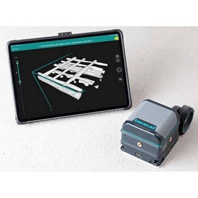
Ground Penetrating Radar | GP8800-Concrete-Scanner
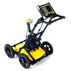
Ground Penetrating Radar | LMX200™
Ground Penetrating Radar | ImpulseRadar Raptor 80 Cart
Ground Penetrating Radar | PinPointR
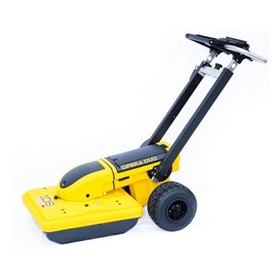
Ground Penetrating Radar | IDS OPERA Duo
Sensors & Software – Ground Penetrating Radar System | LMX100
Sensors & Software – Ground Penetrating Radar System | LMX150
Thanks for your help!
Sorry! Unable to submit your request at this time. Please try again later.
Report this product