

Proceq GS9000 Subsurface Mapping GPR Array ...
Proceq - GS9000 Subsurface Mapping GPR Array Price Guide: $150,000


The GS9000 is a cutting-edge multichannel GPR system designed for efficient subsurface mapping with real-time 3D visualization, ideal for both structural assessments and utility mapping.

Overview
The GS9000 Subsurface Mapping GPR Array is an advanced multichannel ground-penetrating radar system that offers unparalleled efficiency and versatility. With real-time 3D visualization, the GS9000 is equipped with interchangeable GPR arrays, making it suitable for a wide range of applications, including structural assessments and utility mapping. This system is designed to enhance productivity in the field by allowing operators to cover more ground and see results during acquisition.
Key Features
- Multichannel GPR System: Enables high-density 3D mapping for subsurface utility engineering and structural assessments.
- Real-time 3D Visualization: Allows operators to view georeferenced radargrams and time-slice information on-site.
- Interchangeable Arrays: Offers GX1 for structural assessments and GX2 for utility mapping, providing flexibility in applications.
- High Scan Rate: Processes up to 25,000 scans per second, ensuring rapid data collection.
- Integrated GNSS: Provides real-time 3D accuracy with multiband GPS, Glonass, Galileo, and Beidou support.
- IP65 Protection: Ensures durability in various environmental conditions.
Technical Specifications
| Feature | GX1 Array | GX2 Array |
|---|---|---|
| Radar Technology | Stepped-frequency GPR | Stepped-frequency GPR |
| Frequency Range | 500 - 3000 MHz | 30 - 750 MHz |
| Number of Channels | 35 (VV) + 15 (HH) | 11 (VV) |
| Channel Spacing | 2.5 cm (VV), 5.5 cm (HH) | 7.5 cm |
| Scan Width | 0.85 m | 0.82 m |
| Scan Rate | 25000 scans/s | 25000 scans/s |
| Time Window | 35 ns | 100 ns |
| Spatial Interval | Up to 100 scans/m | Up to 100 scans/m |
| Battery | Off-the-shelf power bank x 2 | Off-the-shelf power bank x 2 |
| Autonomy | 6 hours | Hot-swappable | 6 hours | Hot-swappable |
| Dimensions | 772 x 1178 x 443 mm | 772 x 1178 x 443 mm |
| Weight | 45 kg | 45 kg |
| Wheel Encoders | 2, on rear wheels | 2, on rear wheels |
| Operating Temperature | -10° to 50°C | -10° to 50°C |
| Operating Humidity | < 95 % RH, non-condensing | < 95 % RH, non-condensing |
| IP Rating | IP65 | IP65 |
| Connectivity | WiFi, USB-A, USB-C, Lemo (For Positioning) | WiFi, USB-A, USB-C, Lemo (For Positioning) |
| GNSS Satellites | Multiband GPS + Glonass + Galileo + Beidou | Multiband GPS + Glonass + Galileo + Beidou |
| GNSS Real-time Corrections | SSR augmentation or NRTK-compatible | SSR augmentation or NRTK-compatible |
| GNSS Real-time 3D Accuracy | Typ. 1-5 cm | Typ. 1-5 cm |
| GNSS Initialisation | Typ. 5-30 s | Typ. 5-30 s |
Applications
The GS9000 is ideal for a variety of applications, including:
- Subsurface utility engineering (SUE)
- Utility locating and mapping
- Structural assessments for bridges and pavements
- Geophysical investigations
- Archaeology and forensics
- Precision agriculture
Why Choose the GS9000?
The GS9000 offers significant advantages over conventional single-channel GPR systems. It allows for increased area coverage per field day, reduces the need for manually positioned survey lines, and improves coverage in congested corridors. The system's ability to review coverage before leaving the site ensures higher-value mapped deliverables and the combination of GPR and GNSS in one workflow allows for expanded mapping and subsurface modelling capabilities.
To contact PCTE - Construction about Proceq GS9000 Subsurface Mapping GPR Array use Get a quote.
Overview
The GS9000 Subsurface Mapping GPR Array is an advanced multichannel ground-penetrating radar system that offers unparalleled efficiency and versatility. With real-time 3D visualization, the GS9000 is equipped with interchangeable GPR arrays, making it suitable for a wide range of applications, including structural assessments and utility mapping. This system is designed to enhance productivity in the field by allowing operators to cover more ground and see results during acquisition.
Key Features
- Multichannel GPR System: Enables high-density 3D mapping for subsurface utility engineering and structural assessments.
- Real-time 3D Visualization: Allows operators to view georeferenced radargrams and time-slice information on-site.
- Interchangeable Arrays: Offers GX1 for structural assessments and GX2 for utility mapping, providing flexibility in applications.
- High Scan Rate: Processes up to 25,000 scans per second, ensuring rapid data collection.
- Integrated GNSS: Provides real-time 3D accuracy with multiband GPS, Glonass, Galileo, and Beidou support.
- IP65 Protection: Ensures durability in various environmental conditions.
Technical Specifications
| Feature | GX1 Array | GX2 Array |
|---|---|---|
| Radar Technology | Stepped-frequency GPR | Stepped-frequency GPR |
| Frequency Range | 500 - 3000 MHz | 30 - 750 MHz |
| Number of Channels | 35 (VV) + 15 (HH) | 11 (VV) |
| Channel Spacing | 2.5 cm (VV), 5.5 cm (HH) | 7.5 cm |
| Scan Width | 0.85 m | 0.82 m |
| Scan Rate | 25000 scans/s | 25000 scans/s |
| Time Window | 35 ns | 100 ns |
| Spatial Interval | Up to 100 scans/m | Up to 100 scans/m |
| Battery | Off-the-shelf power bank x 2 | Off-the-shelf power bank x 2 |
| Autonomy | 6 hours | Hot-swappable | 6 hours | Hot-swappable |
| Dimensions | 772 x 1178 x 443 mm | 772 x 1178 x 443 mm |
| Weight | 45 kg | 45 kg |
| Wheel Encoders | 2, on rear wheels | 2, on rear wheels |
| Operating Temperature | -10° to 50°C | -10° to 50°C |
| Operating Humidity | < 95 % RH, non-condensing | < 95 % RH, non-condensing |
| IP Rating | IP65 | IP65 |
| Connectivity | WiFi, USB-A, USB-C, Lemo (For Positioning) | WiFi, USB-A, USB-C, Lemo (For Positioning) |
| GNSS Satellites | Multiband GPS + Glonass + Galileo + Beidou | Multiband GPS + Glonass + Galileo + Beidou |
| GNSS Real-time Corrections | SSR augmentation or NRTK-compatible | SSR augmentation or NRTK-compatible |
| GNSS Real-time 3D Accuracy | Typ. 1-5 cm | Typ. 1-5 cm |
| GNSS Initialisation | Typ. 5-30 s | Typ. 5-30 s |
Applications
The GS9000 is ideal for a variety of applications, including:
- Subsurface utility engineering (SUE)
- Utility locating and mapping
- Structural assessments for bridges and pavements
- Geophysical investigations
- Archaeology and forensics
- Precision agriculture
Why Choose the GS9000?
The GS9000 offers significant advantages over conventional single-channel GPR systems. It allows for increased area coverage per field day, reduces the need for manually positioned survey lines, and improves coverage in congested corridors. The system's ability to review coverage before leaving the site ensures higher-value mapped deliverables and the combination of GPR and GNSS in one workflow allows for expanded mapping and subsurface modelling capabilities.
To contact PCTE - Construction about Proceq GS9000 Subsurface Mapping GPR Array use Get a quote.
Calculating...


- Your delivery location?
- NSW
- VIC
- QLD
- SA
- WA
- NT
- ACT
- TAS
- New Zealand
- Papua New Guinea
- Afghanistan
- Albania
- Algeria
- Andorra
- Angola
- Antigua and Barbuda
- Argentina
- Armenia
- Austria
- Azerbaijan
- Bahamas
- Bahrain
- Bangladesh
- Barbados
- Belarus
- Belgium
- Belize
- Benin
- Bhutan
- Bolivia
- Bosnia and Herzegovina
- Botswana
- Brazil
- Brunei
- Bulgaria
- Burkina Faso
- Burma
- Burundi
- Cabo Verde
- Cambodia
- Cameroon
- Canada
- Central African Republic
- Chad
- Chile
- China
- Colombia
- Comoros
- Congo (Brazzaville)
- Congo (Kinshasa)
- Costa Rica
- Côte d'Ivoire
- Croatia
- Cuba
- Cyprus
- Czechia
- Denmark
- Djibouti
- Dominica
- Dominican Republic
- Ecuador
- Egypt
- El Salvador
- Equatorial Guinea
- Eritrea
- Estonia
- Ethiopia
- Fiji
- Finland
- France
- Gabon
- Gambia
- Georgia
- Germany
- Ghana
- Greece
- Grenada
- Guatemala
- Guinea
- Guinea-Bissau
- Guyana
- Haiti
- Holy See
- Honduras
- Hungary
- Iceland
- India
- Indonesia
- Iran
- Iraq
- Ireland
- Israel
- Italy
- Jamaica
- Japan
- Jordan
- Kazakhstan
- Kenya
- Kiribati
- Korea, North
- Korea, South
- Kosovo
- Kuwait
- Kyrgyzstan
- Laos
- Latvia
- Lebanon
- Lesotho
- Liberia
- Libya
- Liechtenstein
- Lithuania
- Luxembourg
- Macedonia
- Madagascar
- Malawi
- Malaysia
- Maldives
- Mali
- Malta
- Marshall Islands
- Mauritania
- Mauritius
- Mexico
- Federated States of Micronesia
- Moldova
- Monaco
- Mongolia
- Montenegro
- Morocco
- Mozambique
- Namibia
- Nauru
- Nepal
- Netherlands
- New Zealand
- Nicaragua
- Niger
- Nigeria
- Norway
- Oman
- Pakistan
- Palau
- Panama
- Papua New Guinea
- Paraguay
- Peru
- Philippines
- Poland
- Portugal
- Qatar
- Romania
- Russia
- Rwanda
- Saint Kitts and Nevis
- Saint Lucia
- Saint Vincent and the Grenadines
- Samoa
- San Marino
- Sao Tome and Principe
- Saudi Arabia
- Senegal
- Serbia
- Seychelles
- Sierra Leone
- Singapore
- Slovakia
- Slovenia
- Solomon Islands
- Somalia
- South Africa
- South Sudan
- Spain
- Sri Lanka
- Sudan
- Suriname
- Swaziland
- Sweden
- Switzerland
- Syria
- Taiwan
- Tajikistan
- Tanzania
- Thailand
- Timor-Leste
- Togo
- Tonga
- Trinidad and Tobago
- Tunisia
- Turkey
- Turkmenistan
- Tuvalu
- Uganda
- Ukraine
- United Arab Emirates
- United Kingdom
- United States
- Uruguay
- Uzbekistan
- Vanuatu
- Venezuela
- Vietnam
- Yemen
- Zambia
- Zimbabwe
- NSW
- VIC
- QLD
- SA
- WA
- NT
- ACT
- TAS
- New Zealand
- Papua New Guinea
- Afghanistan
- Albania
- Algeria
- Andorra
- Angola
- Antigua and Barbuda
- Argentina
- Armenia
- Austria
- Azerbaijan
- Bahamas
- Bahrain
- Bangladesh
- Barbados
- Belarus
- Belgium
- Belize
- Benin
- Bhutan
- Bolivia
- Bosnia and Herzegovina
- Botswana
- Brazil
- Brunei
- Bulgaria
- Burkina Faso
- Burma
- Burundi
- Cabo Verde
- Cambodia
- Cameroon
- Canada
- Central African Republic
- Chad
- Chile
- China
- Colombia
- Comoros
- Congo (Brazzaville)
- Congo (Kinshasa)
- Costa Rica
- Côte d'Ivoire
- Croatia
- Cuba
- Cyprus
- Czechia
- Denmark
- Djibouti
- Dominica
- Dominican Republic
- Ecuador
- Egypt
- El Salvador
- Equatorial Guinea
- Eritrea
- Estonia
- Ethiopia
- Fiji
- Finland
- France
- Gabon
- Gambia
- Georgia
- Germany
- Ghana
- Greece
- Grenada
- Guatemala
- Guinea
- Guinea-Bissau
- Guyana
- Haiti
- Holy See
- Honduras
- Hungary
- Iceland
- India
- Indonesia
- Iran
- Iraq
- Ireland
- Israel
- Italy
- Jamaica
- Japan
- Jordan
- Kazakhstan
- Kenya
- Kiribati
- Korea, North
- Korea, South
- Kosovo
- Kuwait
- Kyrgyzstan
- Laos
- Latvia
- Lebanon
- Lesotho
- Liberia
- Libya
- Liechtenstein
- Lithuania
- Luxembourg
- Macedonia
- Madagascar
- Malawi
- Malaysia
- Maldives
- Mali
- Malta
- Marshall Islands
- Mauritania
- Mauritius
- Mexico
- Federated States of Micronesia
- Moldova
- Monaco
- Mongolia
- Montenegro
- Morocco
- Mozambique
- Namibia
- Nauru
- Nepal
- Netherlands
- New Zealand
- Nicaragua
- Niger
- Nigeria
- Norway
- Oman
- Pakistan
- Palau
- Panama
- Papua New Guinea
- Paraguay
- Peru
- Philippines
- Poland
- Portugal
- Qatar
- Romania
- Russia
- Rwanda
- Saint Kitts and Nevis
- Saint Lucia
- Saint Vincent and the Grenadines
- Samoa
- San Marino
- Sao Tome and Principe
- Saudi Arabia
- Senegal
- Serbia
- Seychelles
- Sierra Leone
- Singapore
- Slovakia
- Slovenia
- Solomon Islands
- Somalia
- South Africa
- South Sudan
- Spain
- Sri Lanka
- Sudan
- Suriname
- Swaziland
- Sweden
- Switzerland
- Syria
- Taiwan
- Tajikistan
- Tanzania
- Thailand
- Timor-Leste
- Togo
- Tonga
- Trinidad and Tobago
- Tunisia
- Turkey
- Turkmenistan
- Tuvalu
- Uganda
- Ukraine
- United Arab Emirates
- United Kingdom
- United States
- Uruguay
- Uzbekistan
- Vanuatu
- Venezuela
- Vietnam
- Yemen
- Zambia
- Zimbabwe

Calculating...

GP8000- Concrete Scanner

GS8000 Lite

Echo Pro Ultrasonic Flaw Detector

PM8000 Cover Meter

GS9000 Subsurface Mapping GPR Array

Concrete Moisture Meter - Positector CMM IS
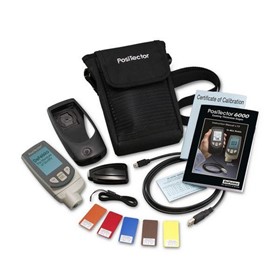
Metal Coating Thickness Gauge - PosiTector 6000
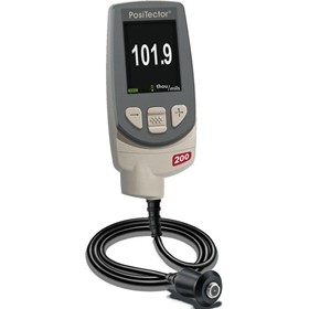
Thickness Gauge - PosiTector 200
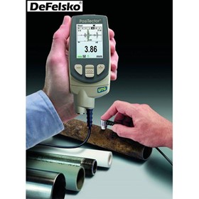
Ultrasonic Wall Thickness Gauge - PosiTector UTG

Schmidt Hammer Concrete Tester

Concrete Thickness Gauge - CTG 2

Concrete Test Hammer - Silver Schmidt Live
Thanks for your help!
Sorry! Unable to submit your request at this time. Please try again later.
Report this product

 Reach valuable industrial buyers in minutes
 Promote key products & content
 Drive cost effective & measurable sales