
Let us get you 3 quotes
Compare and select the best GNSS Receiver
Compare Quotes

Find the right
GNSS Receiver
GNSS Receiver
Join industrial buyers comparing supplier quotes and buying with confidence. Free, quick and easy.

How IndustrySearch works
Tell us what you need
Answer a few quick questions about the equipment you're looking for.
Get personalised quotes
Receive tailored quotes from relevant Australian suppliers.
Compare and choose
Compare quotes, ask questions and choose the best option for you.
Looking to buy the best GNSS Receiver for sale? Get Quotes sends your requirements to expert suppliers in Australia so you get personalised quotes to compare GNSS Receiver prices, specifications, features and terms then choose the one that’s right for you. Also compare servicing, consumables and reviews, so you can buy with confidence.
 Save time
 Compare quotes
 Buy with confidence
Save time, compare quotes & buy with confidence
GNSS Receiver Suppliers
Updated Feb 22, 2024
Supplier Location
Brand
Filter by brand:
Spectra (9)
EMLID (6)
Ospirent (5)
UniStrong (5)
VectorNav (3)
Septentrio (3)
Javad (3)
Griffin (2)
Filter by location:
Brisbane (25)
Melbourne (18)
Adelaide (10)
Perth (9)
Sydney (5)
Hobart (3)
Darwin (3)

Metromatics | Computing, Technology and Embedded solutions
Metromatics Pty Ltd is an Australian-owned engineering and technology company specialising in the design, manufacture, integration and supply of rugged computing, embedded electronics and industrial technology solutions for demanding applications across Australia and New Zealand. Established in 1989, Metromatics provides engineering expertise and complete technology solutions ...
Customers: Raytheon Australia, BAE Systems, Boeing Australia, QR, Transgrid, Snowy Hydro, SAAB, ASC
Metromatics Pty Ltd is an Australian-owned engineering and technology company specialising in the design, manufacture, integration and supply of rugged computing, embedded electronics and industrial technology solutions for demanding applications across Australia and New Zealand. Established in 1989, Metromatics provides engineering expertise and complete technology solutions ...
Customers: Raytheon Australia, BAE Systems, Boeing Australia, QR, Transgrid, Snowy Hydro, SAAB, ASC

VectorNav GNSS Inertial Navigation System (VN-200)
The VN-200 is a versatile GNSS-aided inertial navigation system designed for precise navigation in dynamic environments, ideal for UAVs, ...

VectorNav Dual-Antenna GNSS/INS (VN-300)
The VN-300 offers precise navigation with dual GNSS antennas, ensuring accurate position and true heading even in dynamic environments.

VectorNav High-Precision GNSS/INS VN-210
The VN-210 is a high-precision GNSS/INS system designed for dynamic platforms, offering real-time position, velocity, and attitude data in ...

Trimble Australia | Surveying, Construction & GPS Solutions
Trimble is a leading provider of advanced positioning solutions that maximise productivity and enhance profitability. Though best known for GPS technology, Trimble integrates a wide range of positioning technologies including GPS, laser, optical and inertial technologies with application software, wireless communications, and services to provide complete solutions that are ...
Trimble is a leading provider of advanced positioning solutions that maximise productivity and enhance profitability. Though best known for GPS technology, Trimble integrates a wide range of positioning technologies including GPS, laser, optical and inertial technologies with application software, wireless communications, and services to provide complete solutions that are ...
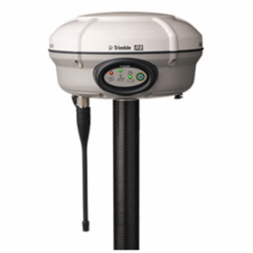
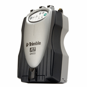

Western Australia Precision Surveys | Survey Equipment
WA Precision Surveys provide clients total positioning solutions for Survey, LIDAR and Machine Control applications. Precise measuring instruments such as total stations, GNSS/GPS equipment , rotating lasers and other equipment for today’s surveying and construction professional are all available for purchase and hire from WA Precision Surveys
WA Precision Surveys provide clients total positioning solutions for Survey, LIDAR and Machine Control applications. Precise measuring instruments such as total stations, GNSS/GPS equipment , rotating lasers and other equipment for today’s surveying and construction professional are all available for purchase and hire from WA Precision Surveys

GNSS-Receivers | NAVCOM LAND-PAK
Thw NAVCOM LAND-PAK GNSS-Receivers rovides an unprecedented level of performance and flexibility by including both RTK and StarFire™ capabilities ...

GNSS-Receivers | NAVCOM SF-3040
The NAVCOM SF-3040 GNSS-Receiver is a lightweight, versatile and reliable StarFire GNSS technology.

BMS LaserSat | Global, Laser and Optical Positioning Solutions
BMS LaserSat Pty Ltd has been selling and servicing laser and machine control systems since 1979. Initially based in North Queensland, we have represented Spectra Physics Laserplane, which later became Spectra Precision and finally Trimble, for thirty-eight years. We provide Australia-wide sales, service and support for the complete range of Trimble products for the agricultural, ...
BMS LaserSat Pty Ltd has been selling and servicing laser and machine control systems since 1979. Initially based in North Queensland, we have represented Spectra Physics Laserplane, which later became Spectra Precision and finally Trimble, for thirty-eight years. We provide Australia-wide sales, service and support for the complete range of Trimble products for the agricultural, ...

Spectra GNSS Receiver | EPOCH 50
The Spectra Precision® EPOCH 50 GNSS receiver, with its 220 channels, makes effective use of the GPS L1/L2/L2C/L5 and GLONASS L1/L2 signals ...

Spectra GNSS Receiver | ProMark 120
The Spectra Precision ProMark™ 120 GNSS system is the most versatile post-processing solution, designed for easy and efficient land survey ...

GlobalPos | Survey Equipment and Machine Control Systems
Our Mission - We are here to help! Positioning and automation equipment technologies are complex technology that is moving fast, gone are the days where a couple of companies dominated the market. The good news is that this added competition naturally brings the price down, and in this case it also has seen the technology improve fast! Companies that once dominated the market ...
Our Mission - We are here to help! Positioning and automation equipment technologies are complex technology that is moving fast, gone are the days where a couple of companies dominated the market. The good news is that this added competition naturally brings the price down, and in this case it also has seen the technology improve fast! Companies that once dominated the market ...

Septentrio Multi-Frequency GNSS Reference Receiver | PolaRx5e
The PolaRx5e is an IP68 compliant GNSS reference receiver complete with battery. It offers GNSS performance identical to that of the PolaRx5. ...

Septentrio Multi-Constellation, Dual-antenna GNSS Receiver | AsteRx-U
Built around Septentrio’s latest ASIC, the GReCo4, it features built-in jamming detection and countermeasures, multi-path rejection and fast ...

GPSat Systems Australia | GNSS Simulation Tools, Sensors and Software
Since 1993 GPSat Systems has been totally committed to GNSS satellite navigation technology innovation and it’s ever evolving practical application to real world problems. We assist both government and business embrace this new technology using world’s best engineering practices and products as they come available. We tackle the GNSS technical challengers that others won’t touch.!! ...
Since 1993 GPSat Systems has been totally committed to GNSS satellite navigation technology innovation and it’s ever evolving practical application to real world problems. We assist both government and business embrace this new technology using world’s best engineering practices and products as they come available. We tackle the GNSS technical challengers that others won’t touch.!! ...

Ospirent GNSS Record & Playback System | GSS6450
The GSS6450 has led the way in combining the practicality and dynamic detail needed for next-generation product development.

Ospirent GNSS Multipath Simulation Software | Sim3D
Multipath and signal obscuration can affect the performance of GNSS receivers, with errors varying according to satellite and environmental ...

CEE HydroSystems | Hydrography, GIS, Geodesy and Dredging Equipments
Established in 1981, BRUTTOUR International provide equipment and services to the survey industry with an emphasis on electronic hydrographic survey equipment. BRUTTOUR specialise in high quality equipment for Hydrography, GIS, Geodesy and Dredging.
Established in 1981, BRUTTOUR International provide equipment and services to the survey industry with an emphasis on electronic hydrographic survey equipment. BRUTTOUR specialise in high quality equipment for Hydrography, GIS, Geodesy and Dredging.


Cody Corporation | Laser, Surveying and Optical equipment
Cody Corporation is the exclusive distributor for a wide range of international manufacturers of laser, surveying and optical equipment. We endeavour to provide the highest quality products and service. We’re a family business based in Adelaide, South Australia, and have been serving the building, construction and surveying industries for over 30 years. Our web store is more than ...
Cody Corporation is the exclusive distributor for a wide range of international manufacturers of laser, surveying and optical equipment. We endeavour to provide the highest quality products and service. We’re a family business based in Adelaide, South Australia, and have been serving the building, construction and surveying industries for over 30 years. Our web store is more than ...

Spectra GNSS Receiver | SP85
The Spectra Geospatial® SP85 is a next generation GNSS receiver that combines decades of GNSS RTK technology with revolutionary new GNSS ...

Spectra GNSS Receiver | SP60
The SP60 is a new generation GNSS receiver offering a high level of flexibility to cover any demand from GIS all the way up to sophisticated ...

HELImetrex | Aerial Imaging & Surveying Equipments
HELImetrex Pty Ltd is a dynamic Australian company specializing in Remotely Piloted Aerial Imaging & Surveying. Based in Brisbane, HELImetrex provides aerial support services to Corporate Business & Industry nationally, including: Mining & Construction companies, Infrastructure Projects, Power Utilities, Oil & Gas projects, Road & Rail projects The focus for HELImetrex is ...
HELImetrex Pty Ltd is a dynamic Australian company specializing in Remotely Piloted Aerial Imaging & Surveying. Based in Brisbane, HELImetrex provides aerial support services to Corporate Business & Industry nationally, including: Mining & Construction companies, Infrastructure Projects, Power Utilities, Oil & Gas projects, Road & Rail projects The focus for HELImetrex is ...

EMLID GNSS Receiver Survey Kit | Reach RS2
Two Reach RS2 receivers for surveying in RTK and PPK modes, Centimeter accuracy for surveying, mapping and data ...
Price Guide: $7,198

EMLID GNSS Receiver Kit | Reach RS+
Two Reach RS+ receivers for surveying in RTK and PPK modes, Centimetre accuracy for surveying, mapping and data ...
Price Guide: $7,198

Advanced Navigation | Navigation Systems
ADVANCED NAVIGATION develops industry-leading navigation systems and robotics technologies for air, land, sea, and space applications. Our mission is to drive the autonomy revolution with AI-powered systems delivering unparalleled capabilities and performance.
ADVANCED NAVIGATION develops industry-leading navigation systems and robotics technologies for air, land, sea, and space applications. Our mission is to drive the autonomy revolution with AI-powered systems delivering unparalleled capabilities and performance.
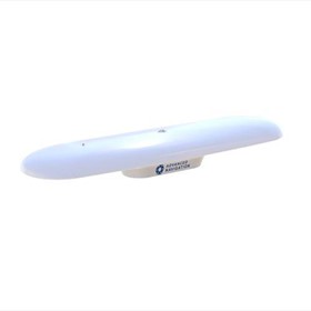

GNSS Receiver
GNSS Receiver
What is a GNSS receiver and how does it work?
A GNSS (Global Navigation Satellite System) receiver is a device that receives signals from multiple satellite constellations, such as GPS, GLONASS, Galileo, and BeiDou, to determine its precise location on Earth. The receiver uses the signals from at least four satellites to calculate its position through a process called trilateration. The receiver measures the time it takes for the signals to travel from the satellites to the receiver, and uses this information to determine the distance between the receiver and each satellite. By combining this distance information with the known positions of the satellites, the receiver can calculate its own position on Earth. GNSS receivers are used in a variety of applications, including navigation, surveying, mapping, and timing.
What is the difference between a single-frequency and dual-frequency GNSS receiver?
A single-frequency GNSS receiver can only receive signals from one frequency band, typically L A dual-frequency GNSS receiver can receive signals from two frequency bands, typically L1 and L Dual-frequency receivers are generally more accurate and can mitigate errors caused by atmospheric conditions and other factors.
What is the accuracy of a GNSS receiver and how is it measured?
A GNSS receiver's accuracy is determined by its ability to calculate the user's position accurately. This accuracy is measured in terms of the receiver's horizontal and vertical position errors. The horizontal position error is the difference between the receiver's calculated position and the true position on the ground, while the vertical position error is the difference between the receiver's calculated altitude and the true altitude. The accuracy of a GNSS receiver can be affected by various factors such as atmospheric conditions, satellite geometry, and receiver quality. The accuracy of a GNSS receiver can be measured using various techniques such as differential GPS, real-time kinematic (RTK) positioning, and post-processing of data.
What is the price range for a GNSS receiver in Australia?
However, the price range for a GNSS receiver in Australia can vary depending on the brand, model, and features. Generally, prices can range from a few hundred dollars to several thousand dollars. It is best to research and compare prices from different retailers to find the best deal.
What are the key features to look for when buying a GNSS receiver?
Accuracy: The accuracy of a GNSS receiver is crucial, and it is important to choose a receiver that can provide the required level of accuracy for the intended application.
- Signal reception: The receiver should be able to receive signals from multiple satellite constellations, including GPS, GLONASS, Galileo, and BeiDou.
- Data output: The receiver should be able to output data in a format that is compatible with the user's software or equipment.
- Durability: The receiver should be able to withstand harsh environmental conditions and be rugged enough to handle rough handling.
- Battery life: The battery life of the receiver is important, especially for fieldwork, and it is important to choose a receiver that can last for the required duration.
- User interface: The receiver should have a user-friendly interface that is easy to navigate and use.
Can a GNSS receiver be used for surveying and mapping applications?
Yes, a GNSS receiver can be used for surveying and mapping applications. GNSS technology provides accurate positioning and timing information, which is essential for surveying and mapping. GNSS receivers can be used for a variety of applications, including topographic mapping, cadastral surveying, construction surveying, and more. However, the accuracy of GNSS measurements can be affected by various factors, such as atmospheric conditions, signal obstructions, and multipath interference. Therefore, it is important to use appropriate surveying techniques and equipment to ensure accurate and reliable results.
What is the battery life of a GNSS receiver and how long does it take to charge?
However, the battery life and charging time of a GNSS receiver can vary depending on the model, usage, and other factors. Generally, GNSS receivers have a battery life of several hours to a few days, depending on the usage and battery capacity. Some high-end models can last up to 20 hours or more on a single charge. The charging time can also vary from a few hours to overnight, depending on the charging method and battery capacity. It is recommended to check the specifications of the GNSS receiver before purchasing to get a better idea of its battery life and charging time.
What is the warranty period for a GNSS receiver and what does it cover?
The warranty period for a GNSS receiver varies depending on the manufacturer and model, but typically ranges from one to three years. The warranty covers defects in materials and workmanship, and may also include repairs or replacements for damage caused by normal use. However, the warranty may not cover damage caused by misuse, neglect, or accidents. It is important to read the warranty terms and conditions carefully before purchasing a GNSS receiver.
What is the support and training available for using a GNSS receiver?
There are various types of support and training available for using a GNSS receiver, including:
- User manuals and online resources: Most GNSS receiver manufacturers provide user manuals and online resources that explain how to use their products. These resources typically cover topics such as receiver setup, data collection, and data processing.
- Technical support: Manufacturers also offer technical support to help users troubleshoot any issues they may encounter while using their receivers. This support may be provided via phone, email, or online chat.
- Training courses: Some manufacturers offer training courses that cover the basics of GNSS technology, as well as how to use their specific receivers. These courses may be offered online or in-person.
- Third-party training: There are also third-party training providers that offer courses on GNSS technology and receiver use. These courses may be more comprehensive than those offered by manufacturers and may cover a wider range of topics.
Are there any regulations or certifications required for using a GNSS receiver in Australia?
Yes, there are regulations and certifications required for using a GNSS receiver in Australia. The Australian Communications and Media Authority (ACMA) regulates the use of radio communications devices, including GNSS receivers, under the Radiocommunications Act 199 GNSS receivers must comply with the ACMA's technical standards and be certified by an accredited testing laboratory before they can be used in Australia. Additionally, certain applications of GNSS technology, such as surveying and mapping, may require specific licenses or permits from state or territory authorities.
Get 3+ Quotes Now - Compare prices, availability and quality. It’s free, quick and secure.
Back to top
GNSS Receiver Costs and Supplier Insights
The listed price of a GNSS Receiver for sale ranges from $500 to $5,000, averaging $2,750.
If you are looking to buy a GNSS Receiver for sale, suppliers on IndustrySearch include Metromatics
Use Get Quotes to receive personalised prices and proposals from trusted suppliers with top reviews and excellent service.
Buy a GNSS Receiver Near Me
Save time and delivery costs while getting fast support, by contacting GNSS Receiver suppliers near you.

Are you a GNSS Receiver supplier?
 Reach valuable industrial buyers in minutes
 Promote key products & content
 Drive cost effective & measurable sales
learn more
Reach valuable industrial buyers in minutes
Promote key products & content
Drive cost effective & measurable sales