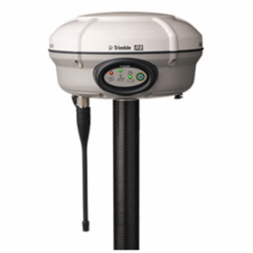

Ospirent GNSS Multipath Simulation Software ...
Ospirent - GNSS Multipath Simulation Software | Sim3D
Multipath and signal obscuration can affect the performance of GNSS receivers, with errors varying according to satellite and environmental conditions.
Accounting for this is vital. Sim3D is the only solution that can give you the level of detail, control, and realism you need to overcome environmental impacts.
Spirent Sim3D is a unique approach to simulating multipath and obscuration based on a true to life synthetic environment. Different realistic environments can be modelled i.e. urban, deep urban, dense forest and highway. The interaction between the signal and the environment (building, cars, pedestrian, trees) is calculated by considering the shadowing and the multipath effects. Multipath can be one of the main sources of error in a GNSS receiver.
Multipath errors can vary from a few metres to hundreds of metres due to the geometry of the satellites and environmental conditions. The characterization and study of multipath is complex but important when its effects need to be compensated in the position, navigation, or timing solution. Sim3D is an innovative real-time system that allows the reproduction of authentic multipath that strictly depends on the environment. The system combines a state-of-the-art GNSS simulator and an advanced GNSS propagation model. The propagation model relies on a 3D-scene of the environment, which is used to generate the multipath and obscuration signature that strictly depends on the location of the receiver’s antenna.
The need for accurate positioning solution has been increasing in recent years, this is because of multiple new applications that rely on accurate positioning, i.e. autonomous vehicle and location-based services. In many cases the accuracy required is expected to be down to cm levels, testing such strict requirements is crucial for the success of such applications.
Key Features:
- Input real-world models, or choose from geo-typical environments
- Supporting all current and planned constellations and frequencies
- Signal code, carrier, and power manipulated by the environment for greater realism
- Up to 31 multipath signals per line of sight (LOS) simulatedSupports GPS, GLONASS, BeiDou, Galileo, QZSS, and SBAS
- Support all frequencies and codes currently simulated by Spirent simulator
- The signal code, carrier, and power are manipulated based on interaction with the environment
- Supports static and dynamic scenarios
- Up to 31 multipath signals per line of sight (LOS) simulated
- Up to 6 reflections per multipath computed
- Ability to generate your own 3D models
- Import externally generated models and objects
- Multiple 3D models are included
- Dynamic trajectory generation
- Support for a scene size of up to 5km2 or greater for highway scenes
- An unprecedented level of control
- Constellation and Frequencies to be used
- Obscuration mode on/off
- Multipath on/off
- Number of reflections per multipath signal
- User-defined filtering algorithms to simulate only multipath in chosen delay/power ranges
- Visualise the multipath direction of arrival
- Building and object materials are modelled and taken into account during the computation
- Support for hardware-in-the-loop setups
To contact GPSat Systems Australia about Ospirent GNSS Multipath Simulation Software | Sim3D use Get a quote.
Accounting for this is vital. Sim3D is the only solution that can give you the level of detail, control, and realism you need to overcome environmental impacts.
Spirent Sim3D is a unique approach to simulating multipath and obscuration based on a true to life synthetic environment. Different realistic environments can be modelled i.e. urban, deep urban, dense forest and highway. The interaction between the signal and the environment (building, cars, pedestrian, trees) is calculated by considering the shadowing and the multipath effects. Multipath can be one of the main sources of error in a GNSS receiver.
Multipath errors can vary from a few metres to hundreds of metres due to the geometry of the satellites and environmental conditions. The characterization and study of multipath is complex but important when its effects need to be compensated in the position, navigation, or timing solution. Sim3D is an innovative real-time system that allows the reproduction of authentic multipath that strictly depends on the environment. The system combines a state-of-the-art GNSS simulator and an advanced GNSS propagation model. The propagation model relies on a 3D-scene of the environment, which is used to generate the multipath and obscuration signature that strictly depends on the location of the receiver’s antenna.
The need for accurate positioning solution has been increasing in recent years, this is because of multiple new applications that rely on accurate positioning, i.e. autonomous vehicle and location-based services. In many cases the accuracy required is expected to be down to cm levels, testing such strict requirements is crucial for the success of such applications.
Key Features:
- Input real-world models, or choose from geo-typical environments
- Supporting all current and planned constellations and frequencies
- Signal code, carrier, and power manipulated by the environment for greater realism
- Up to 31 multipath signals per line of sight (LOS) simulatedSupports GPS, GLONASS, BeiDou, Galileo, QZSS, and SBAS
- Support all frequencies and codes currently simulated by Spirent simulator
- The signal code, carrier, and power are manipulated based on interaction with the environment
- Supports static and dynamic scenarios
- Up to 31 multipath signals per line of sight (LOS) simulated
- Up to 6 reflections per multipath computed
- Ability to generate your own 3D models
- Import externally generated models and objects
- Multiple 3D models are included
- Dynamic trajectory generation
- Support for a scene size of up to 5km2 or greater for highway scenes
- An unprecedented level of control
- Constellation and Frequencies to be used
- Obscuration mode on/off
- Multipath on/off
- Number of reflections per multipath signal
- User-defined filtering algorithms to simulate only multipath in chosen delay/power ranges
- Visualise the multipath direction of arrival
- Building and object materials are modelled and taken into account during the computation
- Support for hardware-in-the-loop setups
To contact GPSat Systems Australia about Ospirent GNSS Multipath Simulation Software | Sim3D use Get a quote.
- Your delivery location?
- NSW
- VIC
- QLD
- SA
- WA
- NT
- ACT
- TAS
- New Zealand
- Papua New Guinea
- Afghanistan
- Albania
- Algeria
- Andorra
- Angola
- Antigua and Barbuda
- Argentina
- Armenia
- Austria
- Azerbaijan
- Bahamas
- Bahrain
- Bangladesh
- Barbados
- Belarus
- Belgium
- Belize
- Benin
- Bhutan
- Bolivia
- Bosnia and Herzegovina
- Botswana
- Brazil
- Brunei
- Bulgaria
- Burkina Faso
- Burma
- Burundi
- Cabo Verde
- Cambodia
- Cameroon
- Canada
- Central African Republic
- Chad
- Chile
- China
- Colombia
- Comoros
- Congo (Brazzaville)
- Congo (Kinshasa)
- Costa Rica
- Côte d'Ivoire
- Croatia
- Cuba
- Cyprus
- Czechia
- Denmark
- Djibouti
- Dominica
- Dominican Republic
- Ecuador
- Egypt
- El Salvador
- Equatorial Guinea
- Eritrea
- Estonia
- Ethiopia
- Fiji
- Finland
- France
- Gabon
- Gambia
- Georgia
- Germany
- Ghana
- Greece
- Grenada
- Guatemala
- Guinea
- Guinea-Bissau
- Guyana
- Haiti
- Holy See
- Honduras
- Hungary
- Iceland
- India
- Indonesia
- Iran
- Iraq
- Ireland
- Israel
- Italy
- Jamaica
- Japan
- Jordan
- Kazakhstan
- Kenya
- Kiribati
- Korea, North
- Korea, South
- Kosovo
- Kuwait
- Kyrgyzstan
- Laos
- Latvia
- Lebanon
- Lesotho
- Liberia
- Libya
- Liechtenstein
- Lithuania
- Luxembourg
- Macedonia
- Madagascar
- Malawi
- Malaysia
- Maldives
- Mali
- Malta
- Marshall Islands
- Mauritania
- Mauritius
- Mexico
- Federated States of Micronesia
- Moldova
- Monaco
- Mongolia
- Montenegro
- Morocco
- Mozambique
- Namibia
- Nauru
- Nepal
- Netherlands
- New Zealand
- Nicaragua
- Niger
- Nigeria
- Norway
- Oman
- Pakistan
- Palau
- Panama
- Papua New Guinea
- Paraguay
- Peru
- Philippines
- Poland
- Portugal
- Qatar
- Romania
- Russia
- Rwanda
- Saint Kitts and Nevis
- Saint Lucia
- Saint Vincent and the Grenadines
- Samoa
- San Marino
- Sao Tome and Principe
- Saudi Arabia
- Senegal
- Serbia
- Seychelles
- Sierra Leone
- Singapore
- Slovakia
- Slovenia
- Solomon Islands
- Somalia
- South Africa
- South Sudan
- Spain
- Sri Lanka
- Sudan
- Suriname
- Swaziland
- Sweden
- Switzerland
- Syria
- Taiwan
- Tajikistan
- Tanzania
- Thailand
- Timor-Leste
- Togo
- Tonga
- Trinidad and Tobago
- Tunisia
- Turkey
- Turkmenistan
- Tuvalu
- Uganda
- Ukraine
- United Arab Emirates
- United Kingdom
- United States
- Uruguay
- Uzbekistan
- Vanuatu
- Venezuela
- Vietnam
- Yemen
- Zambia
- Zimbabwe
- NSW
- VIC
- QLD
- SA
- WA
- NT
- ACT
- TAS
- New Zealand
- Papua New Guinea
- Afghanistan
- Albania
- Algeria
- Andorra
- Angola
- Antigua and Barbuda
- Argentina
- Armenia
- Austria
- Azerbaijan
- Bahamas
- Bahrain
- Bangladesh
- Barbados
- Belarus
- Belgium
- Belize
- Benin
- Bhutan
- Bolivia
- Bosnia and Herzegovina
- Botswana
- Brazil
- Brunei
- Bulgaria
- Burkina Faso
- Burma
- Burundi
- Cabo Verde
- Cambodia
- Cameroon
- Canada
- Central African Republic
- Chad
- Chile
- China
- Colombia
- Comoros
- Congo (Brazzaville)
- Congo (Kinshasa)
- Costa Rica
- Côte d'Ivoire
- Croatia
- Cuba
- Cyprus
- Czechia
- Denmark
- Djibouti
- Dominica
- Dominican Republic
- Ecuador
- Egypt
- El Salvador
- Equatorial Guinea
- Eritrea
- Estonia
- Ethiopia
- Fiji
- Finland
- France
- Gabon
- Gambia
- Georgia
- Germany
- Ghana
- Greece
- Grenada
- Guatemala
- Guinea
- Guinea-Bissau
- Guyana
- Haiti
- Holy See
- Honduras
- Hungary
- Iceland
- India
- Indonesia
- Iran
- Iraq
- Ireland
- Israel
- Italy
- Jamaica
- Japan
- Jordan
- Kazakhstan
- Kenya
- Kiribati
- Korea, North
- Korea, South
- Kosovo
- Kuwait
- Kyrgyzstan
- Laos
- Latvia
- Lebanon
- Lesotho
- Liberia
- Libya
- Liechtenstein
- Lithuania
- Luxembourg
- Macedonia
- Madagascar
- Malawi
- Malaysia
- Maldives
- Mali
- Malta
- Marshall Islands
- Mauritania
- Mauritius
- Mexico
- Federated States of Micronesia
- Moldova
- Monaco
- Mongolia
- Montenegro
- Morocco
- Mozambique
- Namibia
- Nauru
- Nepal
- Netherlands
- New Zealand
- Nicaragua
- Niger
- Nigeria
- Norway
- Oman
- Pakistan
- Palau
- Panama
- Papua New Guinea
- Paraguay
- Peru
- Philippines
- Poland
- Portugal
- Qatar
- Romania
- Russia
- Rwanda
- Saint Kitts and Nevis
- Saint Lucia
- Saint Vincent and the Grenadines
- Samoa
- San Marino
- Sao Tome and Principe
- Saudi Arabia
- Senegal
- Serbia
- Seychelles
- Sierra Leone
- Singapore
- Slovakia
- Slovenia
- Solomon Islands
- Somalia
- South Africa
- South Sudan
- Spain
- Sri Lanka
- Sudan
- Suriname
- Swaziland
- Sweden
- Switzerland
- Syria
- Taiwan
- Tajikistan
- Tanzania
- Thailand
- Timor-Leste
- Togo
- Tonga
- Trinidad and Tobago
- Tunisia
- Turkey
- Turkmenistan
- Tuvalu
- Uganda
- Ukraine
- United Arab Emirates
- United Kingdom
- United States
- Uruguay
- Uzbekistan
- Vanuatu
- Venezuela
- Vietnam
- Yemen
- Zambia
- Zimbabwe
GNSS Integrated Hardware Loop Testing | SimHIL
GNSS Compact Dual Antenna | SPAN CPT7
GNSS Dual Frequency/Multi Constellation | 2000
GNSS Single Frequency | 1000
GNSS Sensor Emulation Software | SimINERTIAL
GNSS Spoofing Simulation Software | SimSAFE
GNSS Multipath Simulation Software | Sim3D
GNSS Record & Playback System | GSS6450
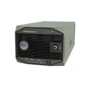
GNSS Simulator | GSS7000
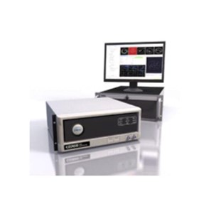
GNSS Simulator | GSS9000 Series
Trimble R8 GNSS Receiver for Surveying
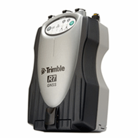
Trimble R7 GNSS Receiver for Surveying
Trimble Zephyr GNSS GPS Antennas
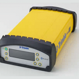
GNSS Reference Receiver for Infrastructure & Network Applications
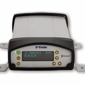
GNSS Reference Receiver NetR8 for Infrastructure & Network
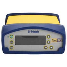
Trimble NetR3 GNSS Reference Sensor for Infrastructure
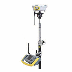
Trimble I.S. Rover : Integrated Surveying GNSS /Total Station System
GNSS Surveying System | Trimble R10
GNSS-Receivers | NAVCOM LAND-PAK
GNSS-Receivers | NAVCOM SF-3040
GNSS Antennas | NAVCOM ANT-3001A
GNSS Antennas | NAVCOM ANT-3001R
GNSS UHF Radios | SATELLINE EASY 1W
GNSS UHF Radios | SATELLINE EASY PRO 35W
GNSS Receiver | EPOCH 50
GNSS Receiver | ProMark 120
GNSS Receiver | ProMark 220
GNSS Spoofing Simulation Software | SimSAFE
GNSS Sensor Emulation Software | SimINERTIAL
Thanks for your help!
Sorry! Unable to submit your request at this time. Please try again later.
Report this product